About Us
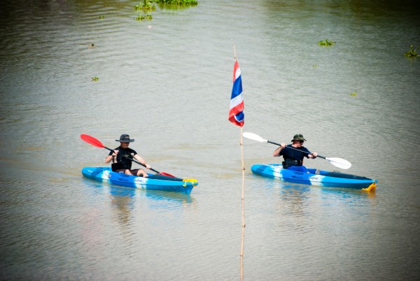
This website lists a number of kayak tracks, which are designed to bring you along the last remaining ancient waterways of the Historic City of Ayutthaya. Ayutthaya was a typically Siamese water-based settlement; one of the characteristics which gave the city its UNESCO World Heritage status.
Unfortunately, Ayutthaya's waterways - the ancient transport and travel facilities - are fast disappearing. Many canals became stagnant, choked with urban trash or ran dry due to silting and lack of maintenance. Many more were claimed to make way for embankments such as concrete roads. On the City Island only a few canals remain of which Khlong Makham Riang and Khlong Tho are the largest, but regrettably, they look like open sewers. Ayutthaya, "The Venice of the East", became a far cry; shame is the name.
But not everything is lost. Water still plays a vital role for the local communities, who use the canals to fish, bathe, wash dishes and clothing, and irrigate their gardens. Children still run along its banks and swim in its muddy waters, filled with a diversity of fishes and wild life. Birds still live in abundance in the lush vegetation along the forgotten canals; a paradise for bird lovers.
Off the City Island, we still find some navigable canals, however the seasonal aspect has to be taken in mind. Some canals tend to have low water levels in the hot period and the packs of water hyacinth can be a burden. Kayakable canals are: in the north the old Lopburi River presently called Khlong Bang Khuat or Khlong Hua Ro; in the east - in the ancient Ayodhya area - Khlong Hantra and in the south Khlong Takhian.
On the site you will find different tested kayak tracks described for each of these zones. Additional information and photographs on Points of Interest, Reference Points and the History of Ayutthaya (including downloadable PDF-files on subject) can be also found.
